
Tournai topographic map
Interactive map
Click on the map to display elevation.
About this map
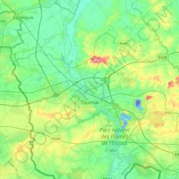
Name: Tournai topographic map, elevation, terrain.
Location: Tournai, Tournai-Mouscron, Hainaut, Wallonia, Belgium (50.55247 3.24402 50.68878 3.57689)
Average elevation: 121 ft
Minimum elevation: -348 ft
Maximum elevation: 459 ft
Other topographic maps
Click on a map to view its topography, its elevation and its terrain.