
Tarakan topographic map
Interactive map
Click on the map to display elevation.
About this map
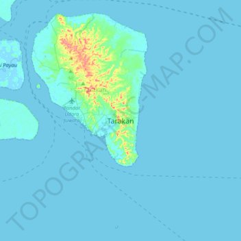
Name: Tarakan topographic map, elevation, terrain.
Location: Tarakan, North Kalimantan, 77112, Indonesia (3.14002 117.47302 3.46002 117.79302)
Average elevation: 16 ft
Minimum elevation: -7 ft
Maximum elevation: 312 ft
Other topographic maps
Click on a map to view its topography, its elevation and its terrain.