
Williamsburg topographic map
Interactive map
Click on the map to display elevation.
About this map
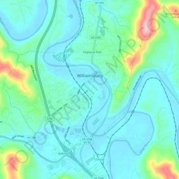
Name: Williamsburg topographic map, elevation, terrain.
Location: Williamsburg, Whitley County, Kentucky, 40769, United States (36.71760 -84.18841 36.76216 -84.14341)
Average elevation: 1,056 ft
Minimum elevation: 899 ft
Maximum elevation: 1,683 ft
Whitley County trails, hiking, mountain biking, running and outdoor activities
Other topographic maps
Click on a map to view its topography, its elevation and its terrain.