
Wuwei topographic map
Interactive map
Click on the map to display elevation.
About this map
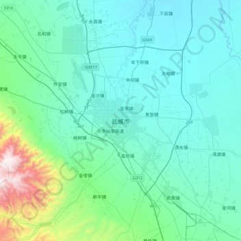
Name: Wuwei topographic map, elevation, terrain.
Location: Wuwei, Liangzhou District, Wuwei, Gansu, China (37.76888 102.47599 38.08888 102.79599)
Average elevation: 5,446 ft
Minimum elevation: 4,797 ft
Maximum elevation: 9,528 ft
Other topographic maps
Click on a map to view its topography, its elevation and its terrain.