
Thank you for supporting this site ❤️
Make a donation
Make a donation
Gear up for your next adventure:
As an Amazon Associate, this site earns from qualifying purchases at no extra cost to you.
Parker topographic map
Click on the map to display elevation.
Gear up for your next adventure:
As an Amazon Associate, this site earns from qualifying purchases at no extra cost to you.
About this map
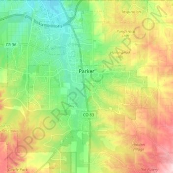
Name: Parker topographic map, elevation, terrain.
Location: Parker, Douglas County, Colorado, 80134, United States (39.45309 -104.82166 39.56590 -104.70849)
Average elevation: 6,056 ft
Minimum elevation: 5,712 ft
Maximum elevation: 6,575 ft
Douglas County trails, hiking, mountain biking, running and outdoor activities
Thank you for supporting this site ❤️
Make a donation
Make a donation
Gear up for your next adventure:
As an Amazon Associate, this site earns from qualifying purchases at no extra cost to you.