
Milan topographic map
Interactive map
Click on the map to display elevation.
About this map
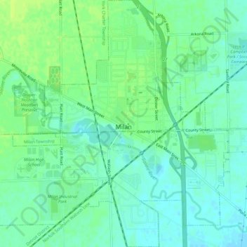
Name: Milan topographic map, elevation, terrain.
Location: Milan, Washtenaw County, Michigan, 48160, United States (42.06666 -83.71036 42.10408 -83.66140)
Average elevation: 699 ft
Minimum elevation: 676 ft
Maximum elevation: 725 ft
Washtenaw County trails, hiking, mountain biking, running and outdoor activities
Other topographic maps
Click on a map to view its topography, its elevation and its terrain.