
Browntown topographic map
Interactive map
Click on the map to display elevation.
About this map
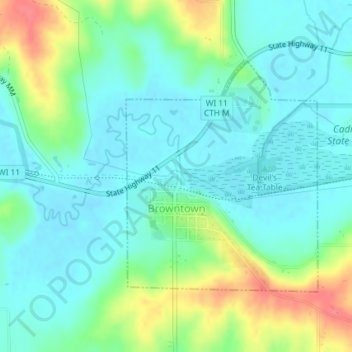
Name: Browntown topographic map, elevation, terrain.
Location: Browntown, Green County, Wisconsin, United States (42.57103 -89.79952 42.58875 -89.77954)
Average elevation: 830 ft
Minimum elevation: 768 ft
Maximum elevation: 984 ft
Green County trails, hiking, mountain biking, running and outdoor activities
Other topographic maps
Click on a map to view its topography, its elevation and its terrain.