
San Pedro topographic map
Interactive map
Click on the map to display elevation.
About this map
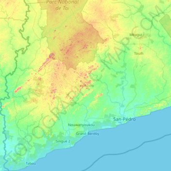
Name: San Pedro topographic map, elevation, terrain.
Location: San Pedro, Bas-Sassandra, Côte d'Ivoire (4.36122 -7.59921 5.66650 -6.30180)
Average elevation: 269 ft
Minimum elevation: 0 ft
Maximum elevation: 1,575 ft
Other topographic maps
Click on a map to view its topography, its elevation and its terrain.