
Brian Head topographic map
Interactive map
Click on the map to display elevation.
Brian Head
The community, at an elevation of 9,800 feet (3,000 m) above sea level, is the highest town in Utah. It is located on State Route 143 and is east of Interstate 15. Brian Head is approximately three miles north of Cedar Breaks National Monument.
About this map
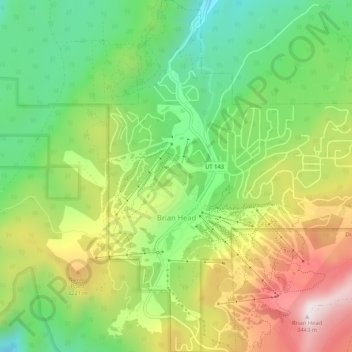
Name: Brian Head topographic map, elevation, terrain.
Location: Brian Head, Iron County, Utah, 84719, United States (37.67689 -112.86086 37.71835 -112.81505)
Average elevation: 9,944 ft
Minimum elevation: 8,953 ft
Maximum elevation: 11,316 ft
Iron County trails, hiking, mountain biking, running and outdoor activities
Other topographic maps
Click on a map to view its topography, its elevation and its terrain.