
Hillsboro topographic map
Interactive map
Click on the map to display elevation.
About this map
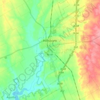
Name: Hillsboro topographic map, elevation, terrain.
Location: Hillsboro, Hill County, Texas, 76645, United States (31.94316 -97.14862 32.05685 -97.08000)
Average elevation: 643 ft
Minimum elevation: 528 ft
Maximum elevation: 823 ft
Hill County trails, hiking, mountain biking, running and outdoor activities
Other topographic maps
Click on a map to view its topography, its elevation and its terrain.