
Rembert topographic map
Interactive map
Click on the map to display elevation.
About this map
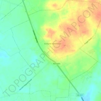
Name: Rembert topographic map, elevation, terrain.
Location: Rembert, Sumter County, South Carolina, United States (34.08059 -80.55580 34.12127 -80.50981)
Average elevation: 207 ft
Minimum elevation: 144 ft
Maximum elevation: 289 ft
Sumter County trails, hiking, mountain biking, running and outdoor activities
Other topographic maps
Click on a map to view its topography, its elevation and its terrain.
Sherwood Forest
United States > South Carolina > Sumter County > East Sumter
Average elevation: 141 ft