
Lendak topographic map
Interactive map
Click on the map to display elevation.
Lendak
The municipality lies at an altitude of 749 metres and covers an area of 19.658 km². It has a population of about 5400 people.
About this map
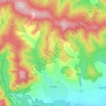
Name: Lendak topographic map, elevation, terrain.
Average elevation: 2,943 ft
Minimum elevation: 2,234 ft
Maximum elevation: 3,829 ft
Other topographic maps
Click on a map to view its topography, its elevation and its terrain.