
Borgfeld topographic map
Interactive map
Click on the map to display elevation.
About this map
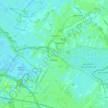
Name: Borgfeld topographic map, elevation, terrain.
Location: Borgfeld, Stadtbezirk Bremen-Ost, Bremen, Deutschland (53.10646 8.86405 53.15237 8.98329)
Average elevation: 13 ft
Minimum elevation: -7 ft
Maximum elevation: 33 ft
Other topographic maps
Click on a map to view its topography, its elevation and its terrain.
Neustadt
Deutschland > Bremen > Bremen
Neustadt, Stadtbezirk Bremen-Süd, Bremen, Deutschland
Average elevation: 23 ft