
Cleveland topographic map
Interactive map
Click on the map to display elevation.
About this map
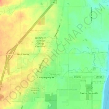
Name: Cleveland topographic map, elevation, terrain.
Location: Cleveland, Manitowoc County, Wisconsin, United States (43.90670 -87.76632 43.93542 -87.71974)
Average elevation: 656 ft
Minimum elevation: 571 ft
Maximum elevation: 745 ft
Manitowoc County trails, hiking, mountain biking, running and outdoor activities
Other topographic maps
Click on a map to view its topography, its elevation and its terrain.