
Mallorytown topographic map
Interactive map
Click on the map to display elevation.
About this map
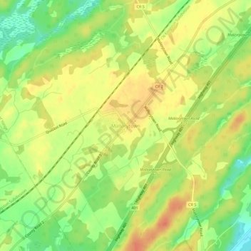
Name: Mallorytown topographic map, elevation, terrain.
Average elevation: 322 ft
Minimum elevation: 240 ft
Maximum elevation: 381 ft
Other topographic maps
Click on a map to view its topography, its elevation and its terrain.
St. Helena Island
Canada > Ontario > Leeds and Grenville Counties > Front of Yonge
St. Helena Island, Front of Yonge, Leeds and Grenville Counties, Eastern Ontario, Ontario, Canada
Average elevation: 377 ft