
Boga Lake topographic map
Interactive map
Click on the map to display elevation.
About this map
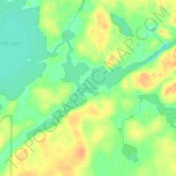
Name: Boga Lake topographic map, elevation, terrain.
Location: Boga Lake, Lake County, Minnesota, United States (47.79775 -91.27329 47.81343 -91.23715)
Average elevation: 1,581 ft
Minimum elevation: 1,522 ft
Maximum elevation: 1,637 ft
Lake County trails, hiking, mountain biking, running and outdoor activities
Other topographic maps
Click on a map to view its topography, its elevation and its terrain.
Boundary Waters Canoe Area Wilderness
United States > Minnesota > Lake County
Average elevation: 1,388 ft