
Solnechnogorsk topographic map
Interactive map
Click on the map to display elevation.
About this map
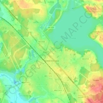
Name: Solnechnogorsk topographic map, elevation, terrain.
Average elevation: 640 ft
Minimum elevation: 554 ft
Maximum elevation: 768 ft
Other topographic maps
Click on a map to view its topography, its elevation and its terrain.
Пятница
Russia > Moscow Oblast > Solnechnogorsky District
Пятница, Solnechnogorsky District, Moscow Oblast, Central Federal District, Russia
Average elevation: 564 ft