
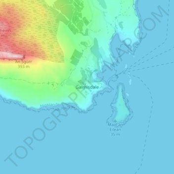
Galmisdale topographic map
Interactive map
Click on the map to display elevation.
About this map
Name: Galmisdale topographic map, elevation, terrain.
Location: Galmisdale, Highland, Scotland, PH42 4RL, United Kingdom (56.85709 -6.15896 56.89709 -6.11896)
Average elevation: 164 ft
Minimum elevation: 0 ft
Maximum elevation: 1,198 ft