
Española topographic map
Interactive map
Click on the map to display elevation.
Española
Española lies at an elevation of around 5,595 feet (1,705 m) with much variance. It is in a valley nestled between the Jemez and Sangre de Cristo mountain ranges, and the meeting point of three rivers, the Rio Grande, the Rio Chama, and the Rio Santa Cruz.
About this map
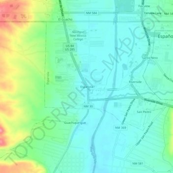
Name: Española topographic map, elevation, terrain.
Average elevation: 5,650 ft
Minimum elevation: 5,564 ft
Maximum elevation: 5,886 ft
Rio Arriba County trails, hiking, mountain biking, running and outdoor activities