
Mogilev District topographic map
Interactive map
Click on the map to display elevation.
About this map
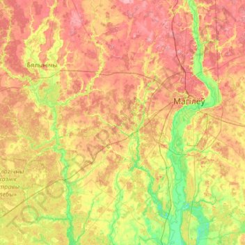
Name: Mogilev District topographic map, elevation, terrain.
Location: Mogilev District, Mahilyow Region, Belarus (53.62098 29.76278 54.08020 30.81665)
Average elevation: 571 ft
Minimum elevation: 433 ft
Maximum elevation: 738 ft
Other topographic maps
Click on a map to view its topography, its elevation and its terrain.
nature
Belarus > Mahilyow Region > Mogilev District > Махаўскі сельскі Савет
Average elevation: 571 ft