
Canby topographic map
Interactive map
Click on the map to display elevation.
About this map
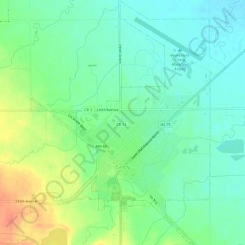
Name: Canby topographic map, elevation, terrain.
Location: Canby, Yellow Medicine County, Minnesota, United States (44.69619 -96.29743 44.73581 -96.25283)
Average elevation: 1,227 ft
Minimum elevation: 1,171 ft
Maximum elevation: 1,332 ft
Yellow Medicine County trails, hiking, mountain biking, running and outdoor activities