
Gobles topographic map
Interactive map
Click on the map to display elevation.
About this map
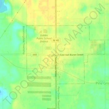
Name: Gobles topographic map, elevation, terrain.
Location: Gobles, Van Buren County, Michigan, United States (42.35373 -85.88890 42.36832 -85.86256)
Average elevation: 804 ft
Minimum elevation: 755 ft
Maximum elevation: 833 ft
Van Buren County trails, hiking, mountain biking, running and outdoor activities
Other topographic maps
Click on a map to view its topography, its elevation and its terrain.