
Güzelyurt topographic map
Interactive map
Click on the map to display elevation.
About this map
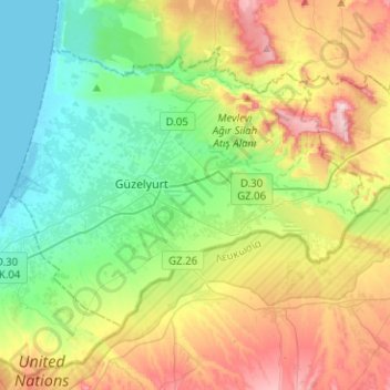
Name: Güzelyurt topographic map, elevation, terrain.
Location: Güzelyurt, Nicosia, Northern Cyprus, 12345, Cyprus (35.11572 32.90931 35.26927 33.16072)
Average elevation: 443 ft
Minimum elevation: -3 ft
Maximum elevation: 1,250 ft
Other topographic maps
Click on a map to view its topography, its elevation and its terrain.