
Thank you for supporting this site ❤️
Make a donation
Make a donation
Gear up for your next adventure:
As an Amazon Associate, this site earns from qualifying purchases at no extra cost to you.
Homosassa topographic map
Click on the map to display elevation.
Thank you for supporting this site ❤️
Make a donation
Make a donation
Gear up for your next adventure:
As an Amazon Associate, this site earns from qualifying purchases at no extra cost to you.
About this map
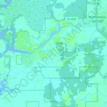
Name: Homosassa topographic map, elevation, terrain.
Location: Homosassa, Citrus County, Florida, 34448, United States (28.75923 -82.64124 28.80562 -82.56649)
Average elevation: 10 ft
Minimum elevation: -3 ft
Maximum elevation: 36 ft
Citrus County trails, hiking, mountain biking, running and outdoor activities
Thank you for supporting this site ❤️
Make a donation
Make a donation
Gear up for your next adventure:
As an Amazon Associate, this site earns from qualifying purchases at no extra cost to you.