
Perryville topographic map
Interactive map
Click on the map to display elevation.
About this map
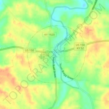
Name: Perryville topographic map, elevation, terrain.
Location: Perryville, Boyle County, Kentucky, United States (37.64256 -84.96008 37.65679 -84.94186)
Average elevation: 899 ft
Minimum elevation: 827 ft
Maximum elevation: 958 ft
Boyle County trails, hiking, mountain biking, running and outdoor activities
Other topographic maps
Click on a map to view its topography, its elevation and its terrain.