
Artemisa topographic map
Interactive map
Click on the map to display elevation.
About this map
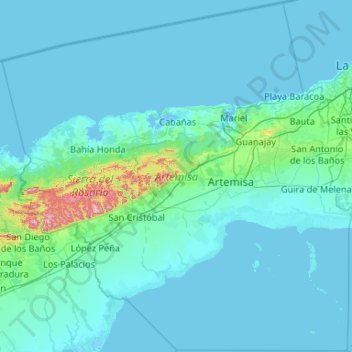
Name: Artemisa topographic map, elevation, terrain.
Location: Artemisa, Cuba (22.34289 -83.44916 23.32014 -82.39527)
Average elevation: 112 ft
Minimum elevation: -7 ft
Maximum elevation: 2,159 ft
Other topographic maps
Click on a map to view its topography, its elevation and its terrain.