
Kobroor topographic map
Interactive map
Click on the map to display elevation.
About this map
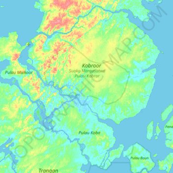
Name: Kobroor topographic map, elevation, terrain.
Location: Kobroor, Aru Islands, Maluku, Indonesia (-6.37400 134.27094 -5.91873 134.78216)
Average elevation: 52 ft
Minimum elevation: -13 ft
Maximum elevation: 259 ft
Other topographic maps
Click on a map to view its topography, its elevation and its terrain.