
Genthin topographic map
Interactive map
Click on the map to display elevation.
About this map
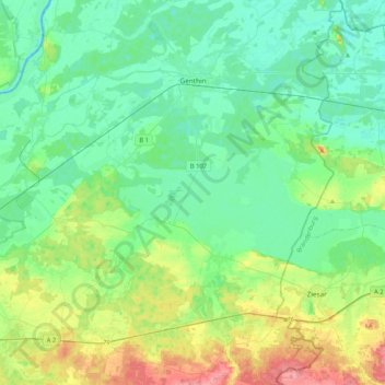
Name: Genthin topographic map, elevation, terrain.
Location: Genthin, Jerichower Land, Saxony-Anhalt, 39307, Germany (52.20513 12.02726 52.45925 12.27317)
Average elevation: 154 ft
Minimum elevation: 89 ft
Maximum elevation: 338 ft