
Haselbach topographic map
Interactive map
Click on the map to display elevation.
About this map
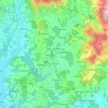
Name: Haselbach topographic map, elevation, terrain.
Average elevation: 1,470 ft
Minimum elevation: 1,070 ft
Maximum elevation: 2,635 ft
Other topographic maps
Click on a map to view its topography, its elevation and its terrain.
Falkenfels
Germany > Bavaria > Landkreis Straubing-Bogen > Falkenfels
Falkenfels, Mitterfels (VGem), Landkreis Straubing-Bogen, Bavaria, 94350, Germany
Average elevation: 1,473 ft