
Odessa topographic map
Interactive map
Click on the map to display elevation.
About this map
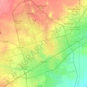
Name: Odessa topographic map, elevation, terrain.
Location: Odessa, Ector County, Texas, United States (31.79747 -102.44206 31.96315 -102.24818)
Average elevation: 2,933 ft
Minimum elevation: 2,825 ft
Maximum elevation: 3,038 ft
Ector County trails, hiking, mountain biking, running and outdoor activities
Other topographic maps
Click on a map to view its topography, its elevation and its terrain.