
Taman Seruni Indah topographic map
Interactive map
Click on the map to display elevation.
About this map
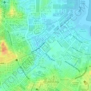
Name: Taman Seruni Indah topographic map, elevation, terrain.
Location: Taman Seruni Indah, Batam City, Riau Islands, 29456, Indonesia (1.11992 104.02978 1.13992 104.04978)
Average elevation: 52 ft
Minimum elevation: -7 ft
Maximum elevation: 171 ft
Other topographic maps
Click on a map to view its topography, its elevation and its terrain.