
Crosslake topographic map
Interactive map
Click on the map to display elevation.
About this map
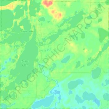
Name: Crosslake topographic map, elevation, terrain.
Location: Crosslake, Crow Wing County, Minnesota, 56442, United States (46.63103 -94.15667 46.71852 -94.02943)
Average elevation: 1,240 ft
Minimum elevation: 1,188 ft
Maximum elevation: 1,375 ft
Crow Wing County trails, hiking, mountain biking, running and outdoor activities
Other topographic maps
Click on a map to view its topography, its elevation and its terrain.