
powiat jasielski topographic map
Interactive map
Click on the map to display elevation.
About this map
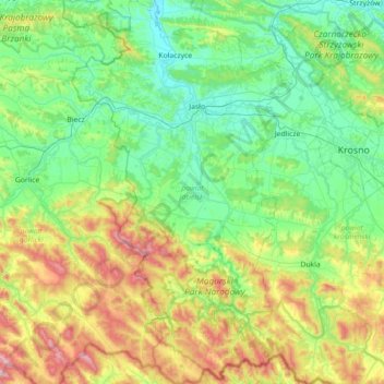
Name: powiat jasielski topographic map, elevation, terrain.
Location: powiat jasielski, Subcarpathian Voivodeship, Poland (49.41225 21.24177 49.87303 21.65098)
Average elevation: 1,302 ft
Minimum elevation: 676 ft
Maximum elevation: 3,123 ft
Other topographic maps
Click on a map to view its topography, its elevation and its terrain.