
Dardanelles topographic map
Interactive map
Click on the map to display elevation.
About this map
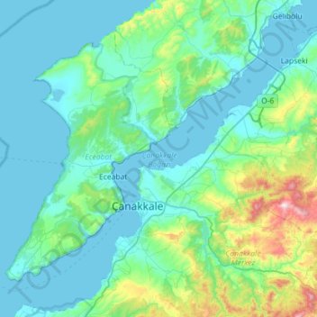
Name: Dardanelles topographic map, elevation, terrain.
Location: Dardanelles, Lapseki, Canakkale, Marmara Region, Türkiye (39.99836 26.17524 40.42002 26.74437)
Average elevation: 404 ft
Minimum elevation: 0 ft
Maximum elevation: 2,999 ft