
Łobez County topographic map
Interactive map
Click on the map to display elevation.
About this map
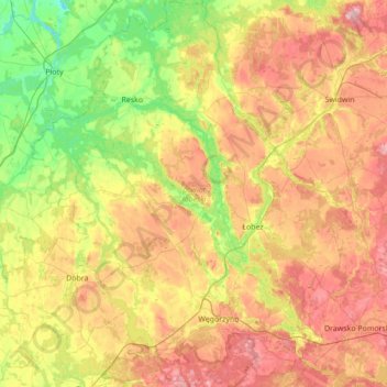
Name: Łobez County topographic map, elevation, terrain.
Location: Łobez County, West Pomeranian Voivodeship, Poland (53.46804 15.14462 53.87782 15.79997)
Average elevation: 279 ft
Minimum elevation: 49 ft
Maximum elevation: 568 ft
Other topographic maps
Click on a map to view its topography, its elevation and its terrain.
Wzgórze Grodowe
Poland > West Pomeranian Voivodeship > Pyrzyce County > Lipiany
Average elevation: 220 ft