
Kosi River topographic map
Interactive map
Click on the map to display elevation.
About this map
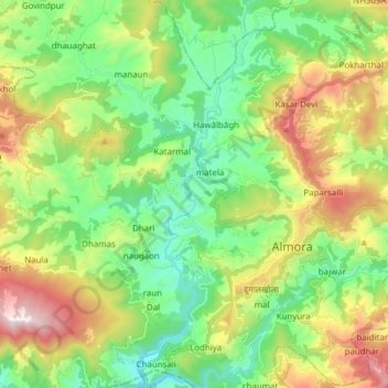
Name: Kosi River topographic map, elevation, terrain.
Location: Kosi River, Almora, Uttarakhand, 263600, India (29.55274 79.60191 29.68657 79.64754)
Average elevation: 4,711 ft
Minimum elevation: 3,415 ft
Maximum elevation: 7,169 ft
Other topographic maps
Click on a map to view its topography, its elevation and its terrain.
Alaknanda River
India > Uttarakhand > Almora
Alaknanda River, Almora, Uttarakhand, 263600, India
Average elevation: 4,564 ft