
Batang Palupuh topographic map
Interactive map
Click on the map to display elevation.
About this map
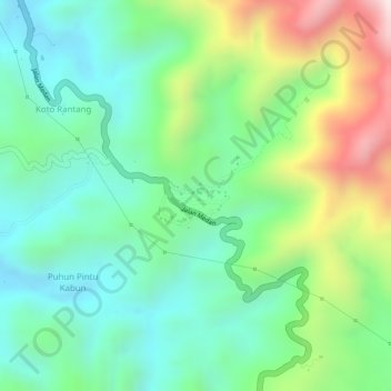
Name: Batang Palupuh topographic map, elevation, terrain.
Location: Batang Palupuh, Agam Regency, West Sumatra, Indonesia (-0.24751 100.34579 -0.24462 100.35042)
Average elevation: 2,992 ft
Minimum elevation: 2,415 ft
Maximum elevation: 4,098 ft