
Midland Township topographic map
Interactive map
Click on the map to display elevation.
About this map
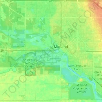
Name: Midland Township topographic map, elevation, terrain.
Location: Midland Township, Midland County, Michigan, United States (43.56854 -84.29072 43.65469 -84.16717)
Average elevation: 627 ft
Minimum elevation: 584 ft
Maximum elevation: 692 ft
Midland County trails, hiking, mountain biking, running and outdoor activities
Other topographic maps
Click on a map to view its topography, its elevation and its terrain.