
Peoria topographic map
Interactive map
Click on the map to display elevation.
About this map
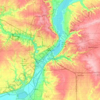
Name: Peoria topographic map, elevation, terrain.
Location: Peoria, Peoria County, Illinois, 61602-6199, United States (40.53386 -89.74910 40.85386 -89.42910)
Average elevation: 643 ft
Minimum elevation: 430 ft
Maximum elevation: 850 ft
Peoria County trails, hiking, mountain biking, running and outdoor activities
Other topographic maps
Click on a map to view its topography, its elevation and its terrain.