
Elgin topographic map
Interactive map
Click on the map to display elevation.
About this map
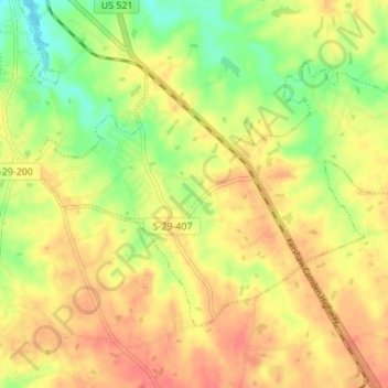
Name: Elgin topographic map, elevation, terrain.
Location: Elgin, Lancaster County, South Carolina, United States (34.65192 -80.75887 34.69016 -80.69060)
Average elevation: 577 ft
Minimum elevation: 466 ft
Maximum elevation: 659 ft
Lancaster County trails, hiking, mountain biking, running and outdoor activities
Other topographic maps
Click on a map to view its topography, its elevation and its terrain.
Andrew Jackson State Park
United States > South Carolina > Lancaster County > Lancaster
Average elevation: 541 ft