Geolocate

William Howard Taft National Historic Site topographic map

Interactive map

Click on the map to display elevation.

About this map

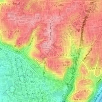
Name: William Howard Taft National Historic Site topographic map, elevation, terrain.

Location: William Howard Taft National Historic Site, Mount Auburn Historic District, Mount Auburn, Cincinnati, Hamilton County, Ohio, United States of America (39.11930 -84.50869 39.12002 -84.50777)

Average elevation: 722 ft

Minimum elevation: 463 ft

Maximum elevation: 889 ft

Other topographic maps

Click on a map to view its topography, its elevation and its terrain.

Mount Airy Forest

United States of America > Ohio > Cincinnati > Mount Airy Center

Mount Airy Forest, Mount Airy Center, Cincinnati, Hamilton County, Ohio, United States of America

Average elevation: 755 ft

Sawyer Point Park

United States of America > Ohio > Cincinnati

Sawyer Point Park, Lytle Park Historic District, Central Business District, Cincinnati, Hamilton County, Ohio, United States of America

Average elevation: 545 ft