Geolocate

Harrington topographic map

Interactive map

Click on the map to display elevation.

About this map

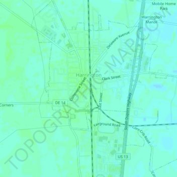
Name: Harrington topographic map, elevation, terrain.

Location: Harrington, Kent County, Delaware, 19952, United States (38.90579 -75.59069 38.93679 -75.55149)

Average elevation: 56 ft

Minimum elevation: 46 ft

Maximum elevation: 66 ft

Kent County trails, hiking, mountain biking, running and outdoor activities

Other topographic maps

Click on a map to view its topography, its elevation and its terrain.

Woodside

United States > Delaware > Kent County

Average elevation: 56 ft

Farmington

United States > Delaware > Kent County

Average elevation: 59 ft

South Bowers

United States > Delaware > Kent County

Average elevation: 0 ft

Leipsic

United States > Delaware > Kent County

Average elevation: 10 ft

Kenton

United States > Delaware > Kent County

Average elevation: 59 ft

Hartly

United States > Delaware > Kent County

Average elevation: 72 ft

Blackiston

United States > Delaware > Kent County

Average elevation: 69 ft

Twin Eagle Farms

United States > Delaware > Kent County

Average elevation: 69 ft

Windy Way

United States > Delaware > Kent County

Average elevation: 33 ft

Carriage Lane

United States > Delaware > Kent County

Average elevation: 33 ft

Hollandsville

United States > Delaware > Kent County

Average elevation: 62 ft

Woodstock Court

United States > Delaware > Kent County > Dover

Average elevation: 43 ft