
Uiwang topographic map
Interactive map
Click on the map to display elevation.
About this map
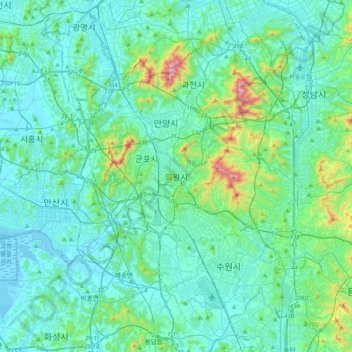
Name: Uiwang topographic map, elevation, terrain.
Location: Uiwang, Uiwang-si, Gyeonggi-do, 16075, South Korea (37.18491 126.80899 37.50491 127.12899)
Average elevation: 272 ft
Minimum elevation: -7 ft
Maximum elevation: 1,972 ft