
Appenwihr topographic map
Interactive map
Click on the map to display elevation.
About this map
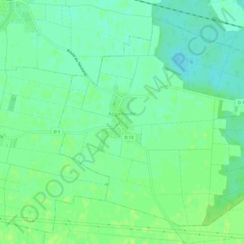
Name: Appenwihr topographic map, elevation, terrain.
Average elevation: 633 ft
Minimum elevation: 614 ft
Maximum elevation: 650 ft
Other topographic maps
Click on a map to view its topography, its elevation and its terrain.
Le Markstein
France > Grand Est > Haut-Rhin > Fellering
Le Markstein is a winter sports station in the Vosges mountains in France situated at an altitude of between 1,020 m (3,346 ft) and 1,268 m (4,160 ft) which is located on the Route des Crêtes. It forms a set of cross-country skiing with the Breitfirst ski-station and the Grand Ballon. The highest point is the…
Average elevation: 3,323 ft