
Eolia topographic map
Interactive map
Click on the map to display elevation.
About this map
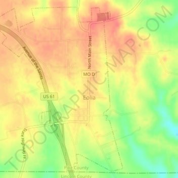
Name: Eolia topographic map, elevation, terrain.
Location: Eolia, Pike County, Missouri, 63344, United States (39.22472 -91.02745 39.24958 -91.00161)
Average elevation: 810 ft
Minimum elevation: 692 ft
Maximum elevation: 879 ft
Pike County trails, hiking, mountain biking, running and outdoor activities
Other topographic maps
Click on a map to view its topography, its elevation and its terrain.