
Zarqa topographic map
Interactive map
Click on the map to display elevation.
Zarqa
Zarqa has a cold semi-arid climate (Köppen climate classification: BSk). The average annual temperature is 17.4 °C (63.3 °F), and around 182 mm (7.17 in) of precipitation falls annually, mostly in winter months. Zarqa's elevation is 619 meters above sea level, and the city occasionally receives snowfall in winter.
About this map
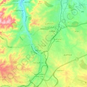
Name: Zarqa topographic map, elevation, terrain.
Location: Zarqa, Zarqa Sub-District, Zarqa Qasabah, Zarqa, Jordan (32.01972 36.01747 32.11856 36.13389)
Average elevation: 2,024 ft
Minimum elevation: 1,611 ft
Maximum elevation: 2,648 ft