
Fuglafjørður topographic map
Interactive map
Click on the map to display elevation.
About this map
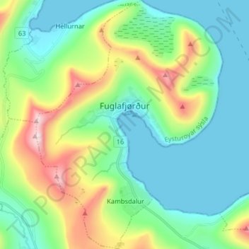
Name: Fuglafjørður topographic map, elevation, terrain.
Location: Fuglafjørður, Eysturoy region, 530, Faroe Islands (62.20902 -6.86173 62.26936 -6.76433)
Average elevation: 643 ft
Minimum elevation: -26 ft
Maximum elevation: 2,398 ft