Geolocate

Great Stirrup Cay topographic map

Interactive map

Click on the map to display elevation.

About this map

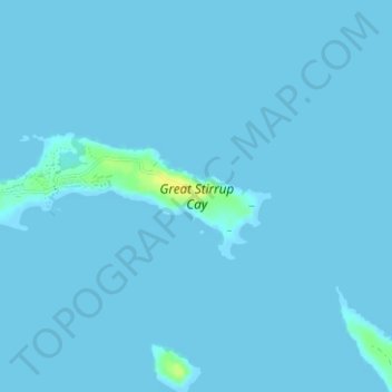
Name: Great Stirrup Cay topographic map, elevation, terrain.

Location: Great Stirrup Cay, Berry Islands, The Bahamas (25.81854 -77.92621 25.82774 -77.89480)

Average elevation: 3 ft

Minimum elevation: 0 ft

Maximum elevation: 62 ft

Other topographic maps

Click on a map to view its topography, its elevation and its terrain.

Great Harbour Cay

The Bahamas > Berry Islands

Great Harbour Cay, Berry Islands, The Bahamas

Average elevation: 3 ft

Whale Cay

The Bahamas > Berry Islands

Whale Cay, Berry Islands, The Bahamas

Average elevation: 3 ft

Devil's Cay

The Bahamas > Berry Islands

Devil's Cay, Berry Islands, The Bahamas

Average elevation: 3 ft

CocoCay

The Bahamas > Berry Islands

CocoCay, Berry Islands, The Bahamas

Average elevation: 0 ft