Geolocate

Great Harbour Cay topographic map

Interactive map

Click on the map to display elevation.

About this map

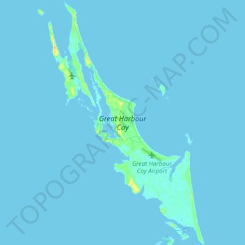
Name: Great Harbour Cay topographic map, elevation, terrain.

Location: Great Harbour Cay, Berry Islands, The Bahamas (25.69263 -77.88968 25.81665 -77.81037)

Average elevation: 3 ft

Minimum elevation: -3 ft

Maximum elevation: 79 ft

Other topographic maps

Click on a map to view its topography, its elevation and its terrain.

Whale Cay

The Bahamas > Berry Islands

Whale Cay, Berry Islands, The Bahamas

Average elevation: 3 ft

Devil's Cay

The Bahamas > Berry Islands

Devil's Cay, Berry Islands, The Bahamas

Average elevation: 3 ft

CocoCay

The Bahamas > Berry Islands

CocoCay, Berry Islands, The Bahamas

Average elevation: 0 ft

Great Stirrup Cay

The Bahamas > Berry Islands

Great Stirrup Cay, Berry Islands, The Bahamas

Average elevation: 3 ft