
Choszczno County topographic map
Interactive map
Click on the map to display elevation.
About this map
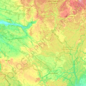
Name: Choszczno County topographic map, elevation, terrain.
Location: Choszczno County, West Pomeranian Voivodeship, Poland (52.94172 15.20501 53.34394 16.03740)
Average elevation: 269 ft
Minimum elevation: 72 ft
Maximum elevation: 617 ft
Other topographic maps
Click on a map to view its topography, its elevation and its terrain.
Wzgórze Grodowe
Poland > West Pomeranian Voivodeship > Pyrzyce County > Lipiany
Average elevation: 220 ft